


New Forest Heathland Lichen Survey 2011 – 2015
NewsThe report on the 2011 – 2015 survey is now out and can be downloaded from The New Forest heathland lichen survey 2011 to 2015. I will use this site to update on further survey after the period covered in the report.
IntroductionI last looked at the lichens of the New Forest heathlands seriously with Francis Rose in the 1990s. In the autumn of 2011, however, a contract recording lichens in randomly chosen plots on the heathlands for the Natural History Museum (NHM) as part of their New Forest Quantitative Inventory concentrated my attention on the New Forest heaths. The result has been a cascade of exciting finds, which will be detailed on the Heathland Lichens section. The quantitative inventory work on the heaths has stimulated an on going survey of the New Forest heathland lichens by 1km national squares, run on a voluntary basis by Neil Sanderson. This aims to cover at least 33% of the heathland of the New Forest grazings using 1km national grid squares as the recording unit.
The NHM's Quantitative Inventory, whilst it produced very useful data that will be subject to statistical analysis, it represented a very limited sample of the heathlands of the Forest. The New Forest Heathland Lichen Survey (NFHLS), by way of contrast is intended to give a wider picture of the diversity of lichens on the New Forest heaths and to give results that can be easily compared to other heathland areas. The strategy for the NFHLS was to survey a representative sample of the New Forest by grid 1km squares, which are simple to define and the results can be easily integrated into national biodiversity recording schemes.
The New Forest Heathland Lichen Survey
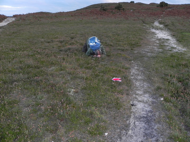
The NHM’s Quantitative Inventory was the impetus to get the NFHLS survey going and the Natural History Museum provided additional help, particularly in running TLC analysis that has been of great help in getting to grips with the minefield of Cladonia taxonomy. Beyond this the survey has been, to date, a spare time activity, typically carried out during dog walks at the weekend and evenings. Some Wessex Lichen Group meetings have contributed to the survey along with more informal Saturday afternoon lichen trips.
Ecological Scope
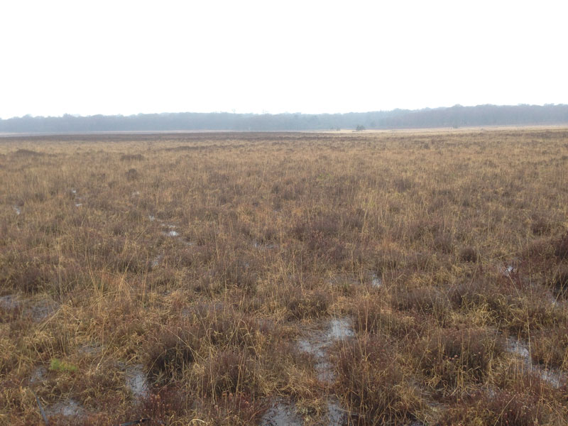
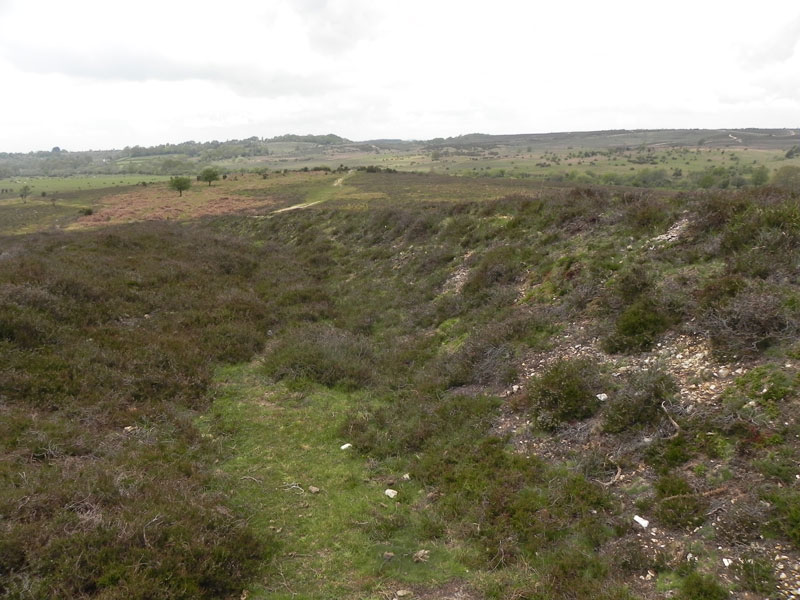
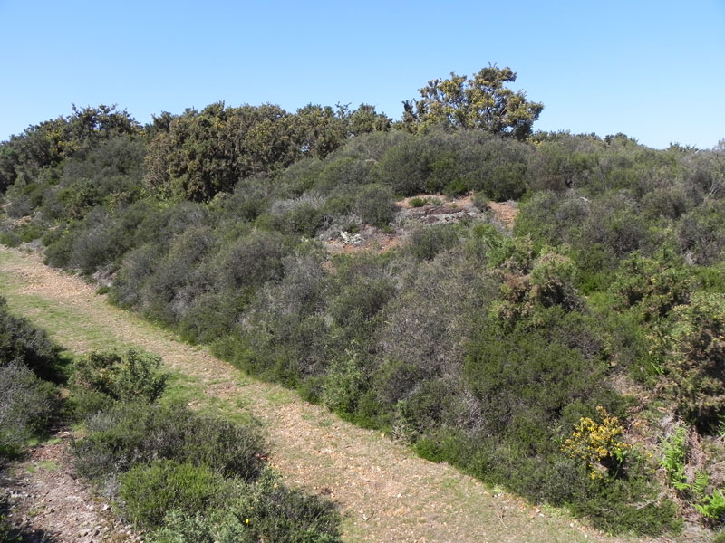
The survey encompassed a wide definition of heathland as all the open rough grazing within the open Forest not just the heather dominated heaths.
The species recorded were lichens and associated fungi found growing on the soil, on stones, including rubble left behind from wartime installations, and species epiphytic on heathers. Species epiphytic on other shrubs and trees and lichens on stumps and dead wood were not recorded.
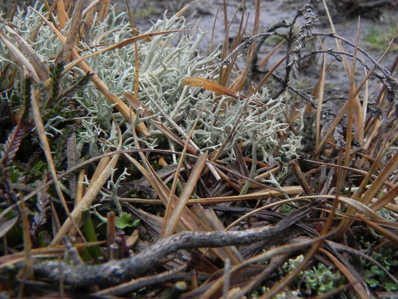
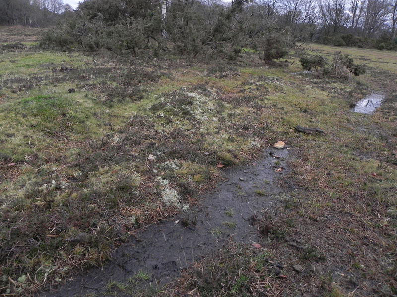
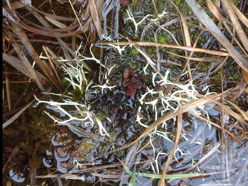
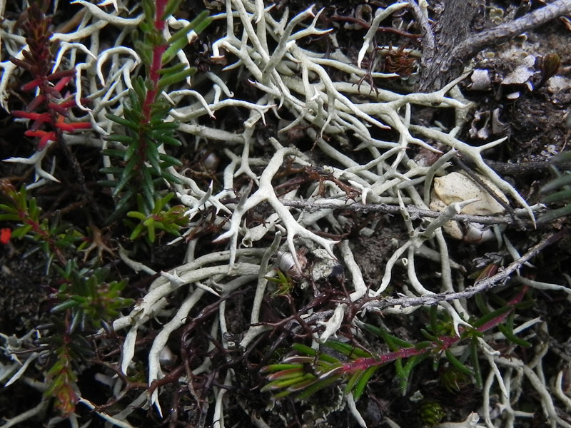
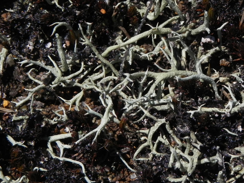
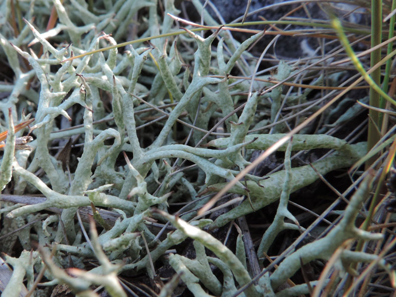
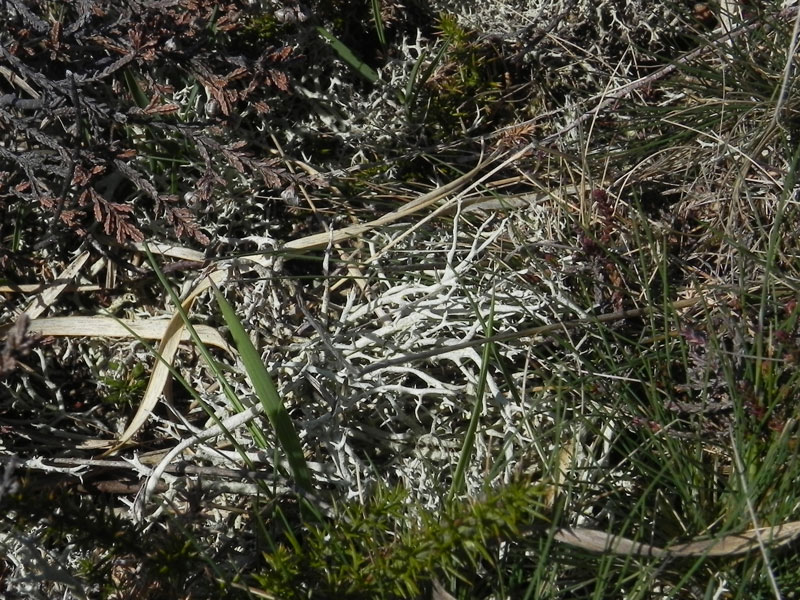
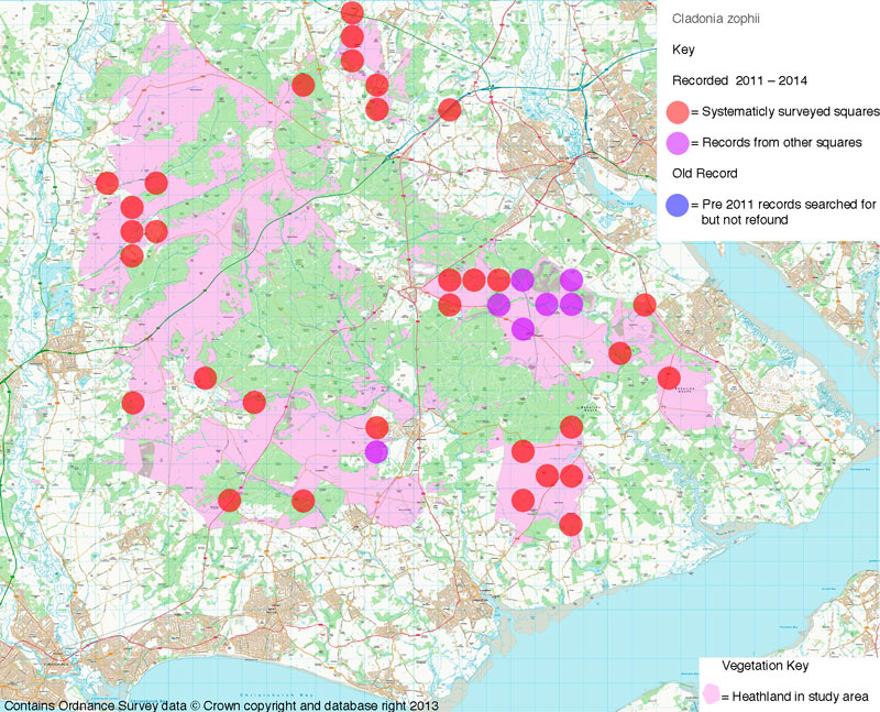
The following pictures show one of the important finds of the survey: Cladonia zopfii, in its varied habitats.
The NHM's Quantitative Inventory, whilst it produced very useful data that will be subject to statistical analysis, it represented a very limited sample of the heathlands of the Forest. The New Forest Heathland Lichen Survey (NFHLS), by way of contrast is intended to give a wider picture of the diversity of lichens on the New Forest heaths and to give results that can be easily compared to other heathland areas. The strategy for the NFHLS was to survey a representative sample of the New Forest by grid 1km squares, which are simple to define and the results can be easily integrated into national biodiversity recording schemes.
The New Forest Heathland Lichen Survey
The NHM’s Quantitative Inventory was the impetus to get the NFHLS survey going and the Natural History Museum provided additional help, particularly in running TLC analysis that has been of great help in getting to grips with the minefield of Cladonia taxonomy. Beyond this the survey has been, to date, a spare time activity, typically carried out during dog walks at the weekend and evenings. Some Wessex Lichen Group meetings have contributed to the survey along with more informal Saturday afternoon lichen trips.Ecological Scope
The survey encompassed a wide definition of heathland as all the open rough grazing within the open Forest not just the heather dominated heaths.The species recorded were lichens and associated fungi found growing on the soil, on stones, including rubble left behind from wartime installations, and species epiphytic on heathers. Species epiphytic on other shrubs and trees and lichens on stumps and dead wood were not recorded.
The following pictures show one of the important finds of the survey: Cladonia zopfii, in its varied habitats.
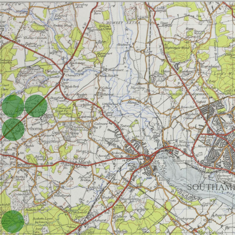
Areas Covered
The 1km squares chosen for survey were partly governed by the occurrence of existing data, including:• One km squares already included within the New Forest Quantitative Inventory.
• One km squares with existing data from the 1990s.
• One km squares recorded as the author was limbering up his Cladonia identification in preparation for the New Forest Quantitative Inventory were a given.
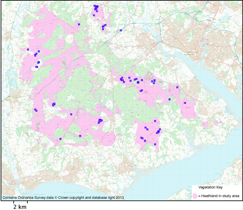
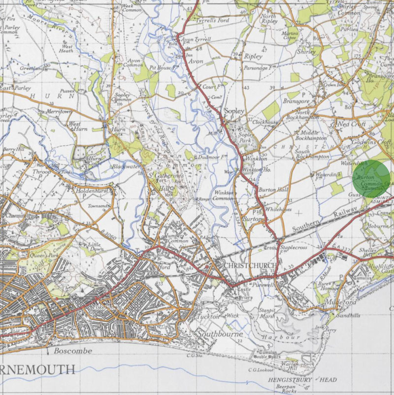
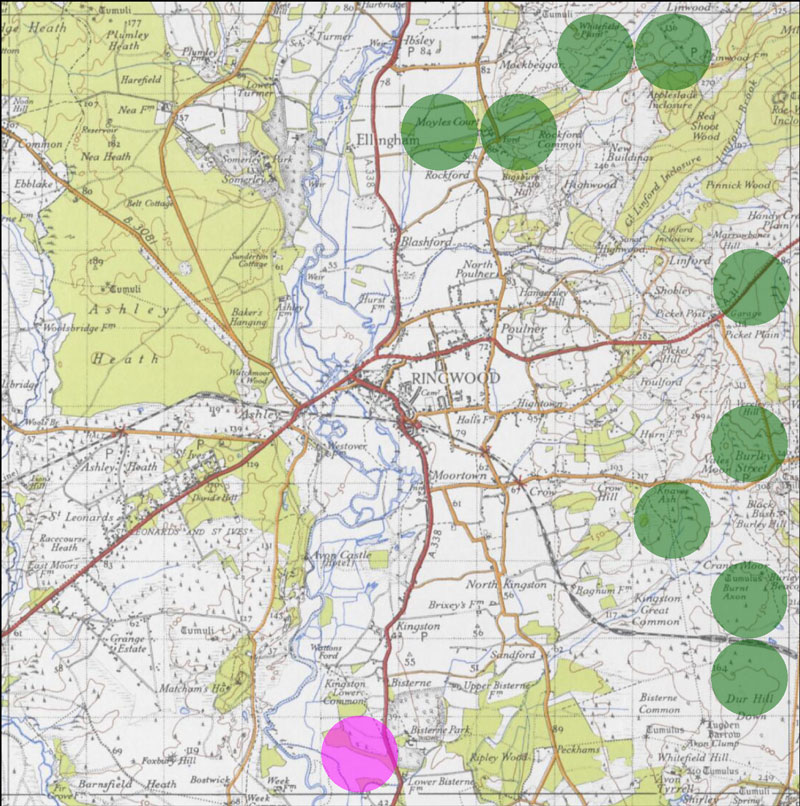
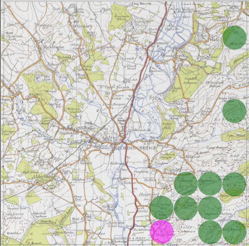
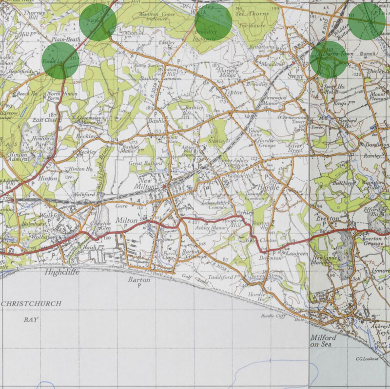
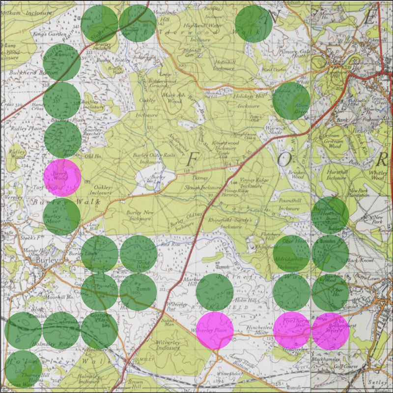
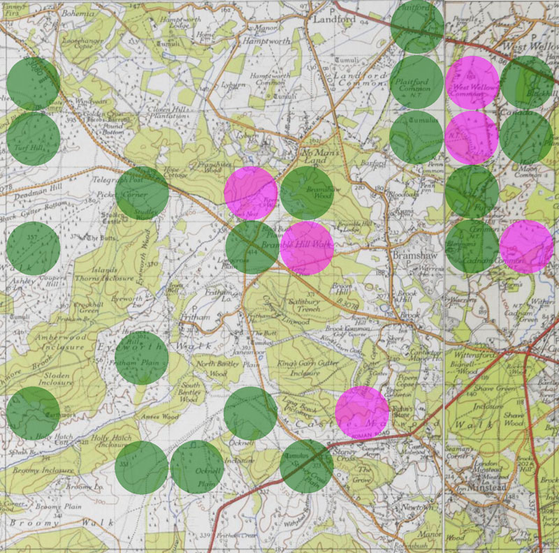
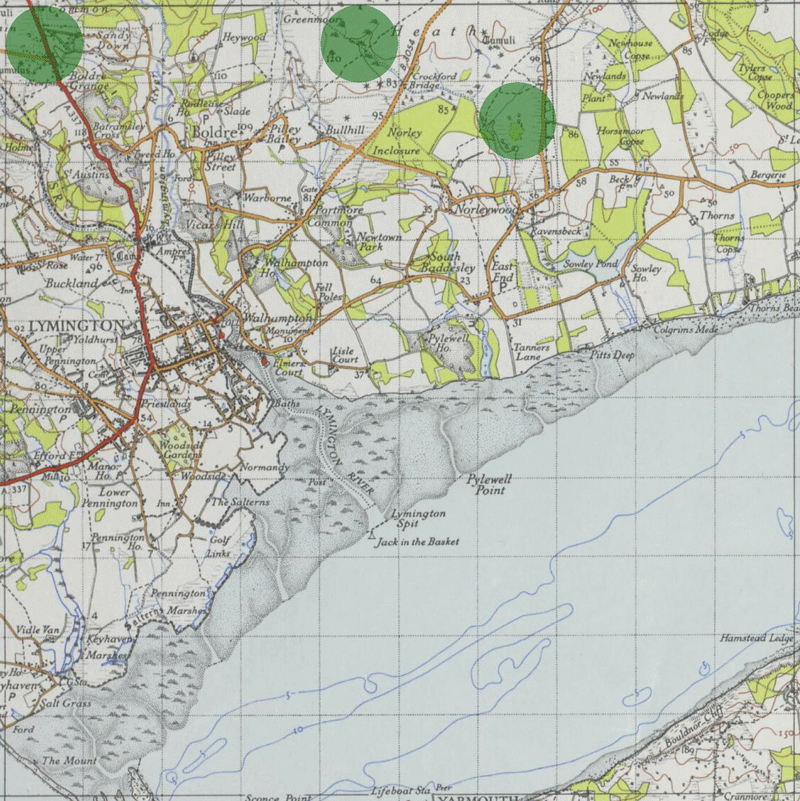
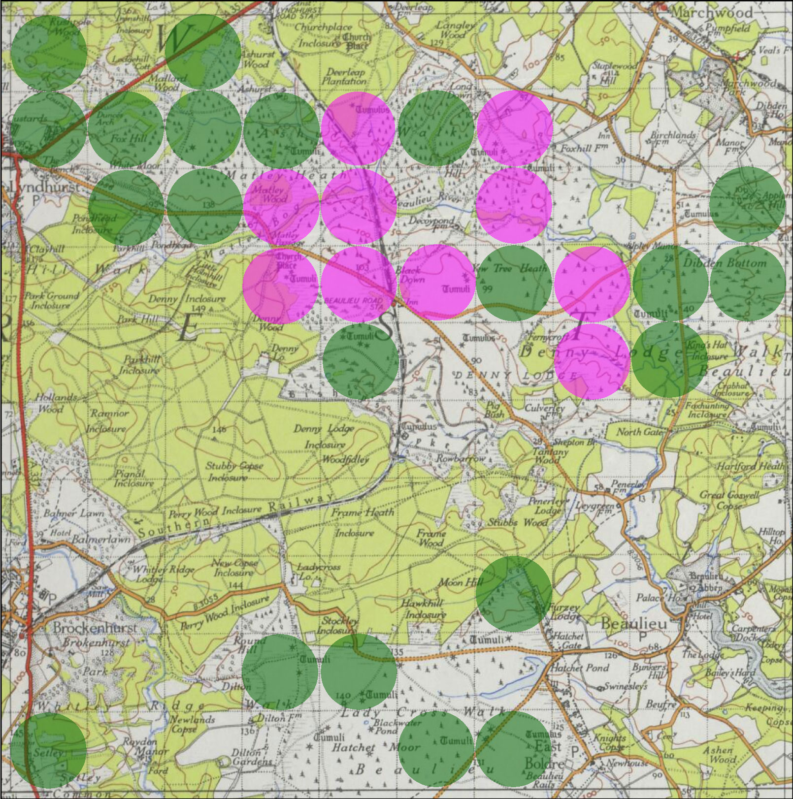
As this was already not random sampling, the numbers of 1km grid squares with heathland on the open Forest in each 10km national grid square were counted (ignoring squares with only a few hectares). Then the number required to get at least 25% coverage was calculated. The additional squares were placed to fill in gaps in geographic coverage and to cover the range of heathland types within the 10km national grid. In addition, any accessible heathlands off the open Forest (the common grazings of the New Forest) but within the New Forest SSSI (or other SSSIs in or very near the National Park) were surveyed. Coverage on the open Forest was later raised to 33% as good progress was being made and some addition squares added to even up coverage between the meta-sites.
This added up to 99 1km grid squares, which was rounded up to 100, with 94 on the open Forest. Species of interest spotted in other 1km squares are also recorded but full surveys of these squares were not intended. To date (February, 2015) 28 additional squares have had species of interest recorded on passing.
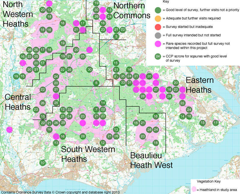
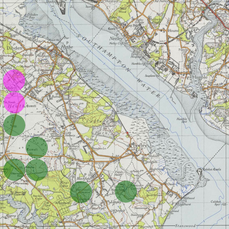
Meta-sites
As the survey progressed in late 2013, it was decided to divide up the heathland by meta-site as a more natural division than by 10km national grid squares. The following areas were devised:Northern Commons: the block of heathlands stretching 4.5km from Plaitford Common to Cadnam Common, mostly owned by the National Trust. Extends eastwards to include relic areas at Copythorn Common. Low rolling terrain in the Bracklesham Group with no gravel terraces. Mostly hard grazed heaths with short swards that have not burned in living memory, including western part of Copythorn Common but the eastern section of Copythorn Common is unmanaged and dominated by tall rank vegetation. Very little military disturbance in WWII.
Eastern Heaths: stretching 16 km from Fair Cross north of Lyndhurst to Beaulieu Heath East and Blackwell Common. Also includes the isolated area east of Backfield at Fields Heath. Low dissected gravel river terraces with extensive areas of slopes in the sands and clays of the Barton Group, with more extensive gravel river terrace burying the clays of the Headon Formation on Beaulieu Heath East to the south east. Includes areas of short grazed heaths near fertile grassland and woods, grading into taller controlled burned heaths more distant from richer grazings. Localised disturbance in WWI and WWII, leaving old gravel pits, shell craters and areas with broken concrete.
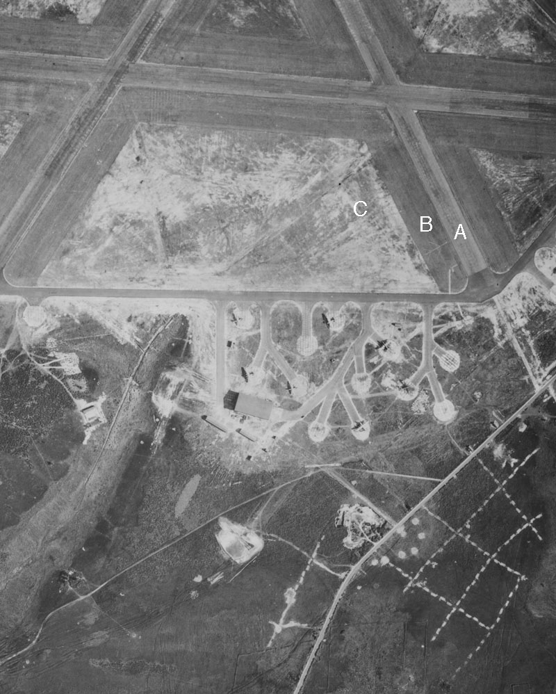
Beaulieu Heath West: a compact block of heathland about 4km across with an extensive gravel river terrace largely burying the more base rich clays of the Headon Formation. Short grazed low productivity heath rare except the along eastern edge close to common edge settlements, where it is locally lichen rich. Gorse particularly frequent drier productive and generally taller heaths, which are lichen poor, but with lichen interest in damper heath and plateau wet heaths. Military disturbance in WWII was extensive around the Beaulieu airfield, with base enriched areas with broken concrete widespread along the sites of the old runways. In addition large areas of heath were levelled within the airfield, stripping the topsoil, on which significant lichen rich patches have developed.
South Western Heaths: stretches 11km from the east of Brockenhurst to the south west of Burley to Dur Hill Down. Includes isolated heathland at Setley Common to the east in the Roydon Wood Nature Reserve and the even more isolated Burton Common to the south west. Low dissected gravel river terraces with extensive areas of slopes in the sands and clays of the Barton Group to the north, with more extensive gravel river terrace burying the clays of the Headon Formation to the south. Localised areas of short grazed heaths near fertile grasslands, grading gradually into taller controlled burned heaths more distant from richer grazings. Localised disturbance in WWII, leaving old gravel pits and areas of broken concrete, with Holmsley airfield in the south west of the area.
Central Heaths: a wide band of heathland stretching 13km from Cranes Moor north west of Burley, to Janesmoor by Fritham, although bisected by the dual carriage way of the A31. Also extends south east down to Acres Down. Dominated by dissected high gravel terraces with sands and clays of the Barton Group on slopes but these are often buried by deep head deposits except on more eroded upper parts of slopes. Large areas are lightly grazed, but shorter more heavily grazed heaths occur near Burley and Fritham and at Acres Down. Rather localised WWII disturbance, except to the north east where Stoney Cross Airfield had a major impact, leaving large areas of concrete enriched ground.
North western Heaths: the largest single block of lowland heathland remaining in England, stretching 11km unbroken north to south and 10km east to west, although with some internal bands of woodland in the latter direction. Dominated by dissected high gravel terraces with sands and clays of the Bracklesham Group on slopes but these are often buried by deep head deposits except on more eroded upper parts of slopes. Grazing pressure very varied with extensive hard grazed heaths with short swards about Ogdens and Linwood with smaller areas about Fritham but rather lightly grazed on the more extensive gravel plateaus with taller controlled burned heathlands dominating. Localised WWII disturbances occurred when the north western area was used as a bombing range.
The distribution of the samples and the areas of the meta-sites can be seen by clicking on the text below.
Progress
By 11th February 2015, all of the squares targeted for survey had been visited, and the level of survey brought to an adequate level.The CCP Index
Some years ago, when discussing with Bryan Edwards (of Dorset Environmental Records Centre and Conservation Officer for the British Lichen Society) what would constitute good way of measuring lichen species diversity within heathland, we agreed that a good patch of heath would be expected to have at least 10 Cladonia species and related taxa. This has now developed into the CCP Index; that is the total numbers of terrestrial Cetrelia, Cladonia & Pycnothelia taxa recorded within a site. This index excludes the smaller terricolous crusts, which, difficult although Cladonia identification can be, are even more inconstantly recorded. It also reduces the variation produced by recorder effort and removes inflated numbers from finding stray common species or intrusive habitats within heathland. As applied to the New Forest the CCP index records various subspecies and varieties as separate taxa. This is a simple index to apply and is giving useful assessments of the diversity of lichen rich heathland habitats. In a New Forest context, a discreet patch of heath would be expected to score at least 10 to be of high interest, while a 1km square, or a site of about 100ha, would be expected score over 15. For this survey the coarsely sorediate pixie cups were recorded as Cladonia chlorophaea s. str., Cladonia grayi s. str. (field identifiable by its strong UV+ fluorescence) and the Cladonia cryptochlorophaea group, which includes definite Cladonia cryptochlorophaea and potentially also Cladonia merochlorophaea and Cladonia novochlorophaea. The latter group of species can not practically be identified in the field. The highest total CCP score recorded from a 1km grid square in the New Forest to date is 35.Other species could be added to bring in northern lowland heaths, probably including the genera Alectoria, Bryoria, Cornicularia and Thamnolia.
Species List
The running species list given, currently standing at 161, along with the frequency of occurrence of species, conservation status and habitat, in the page linked below (last up date 11/11/2015).New Forest Species List
The average numbers of taxa, which are terricolous, saxicolous or corticolous on heathers, recorded in systematically recorded 1 km squares, is 29, ranging from seven to 63 taxa. For the CCP score the average in systematically recorded 1 km squares, is 21 with the range from 5 to 35.